World's First 360° Agro Intelligence Suite

The AI Platform Trusted By
6.2M+ Farmers

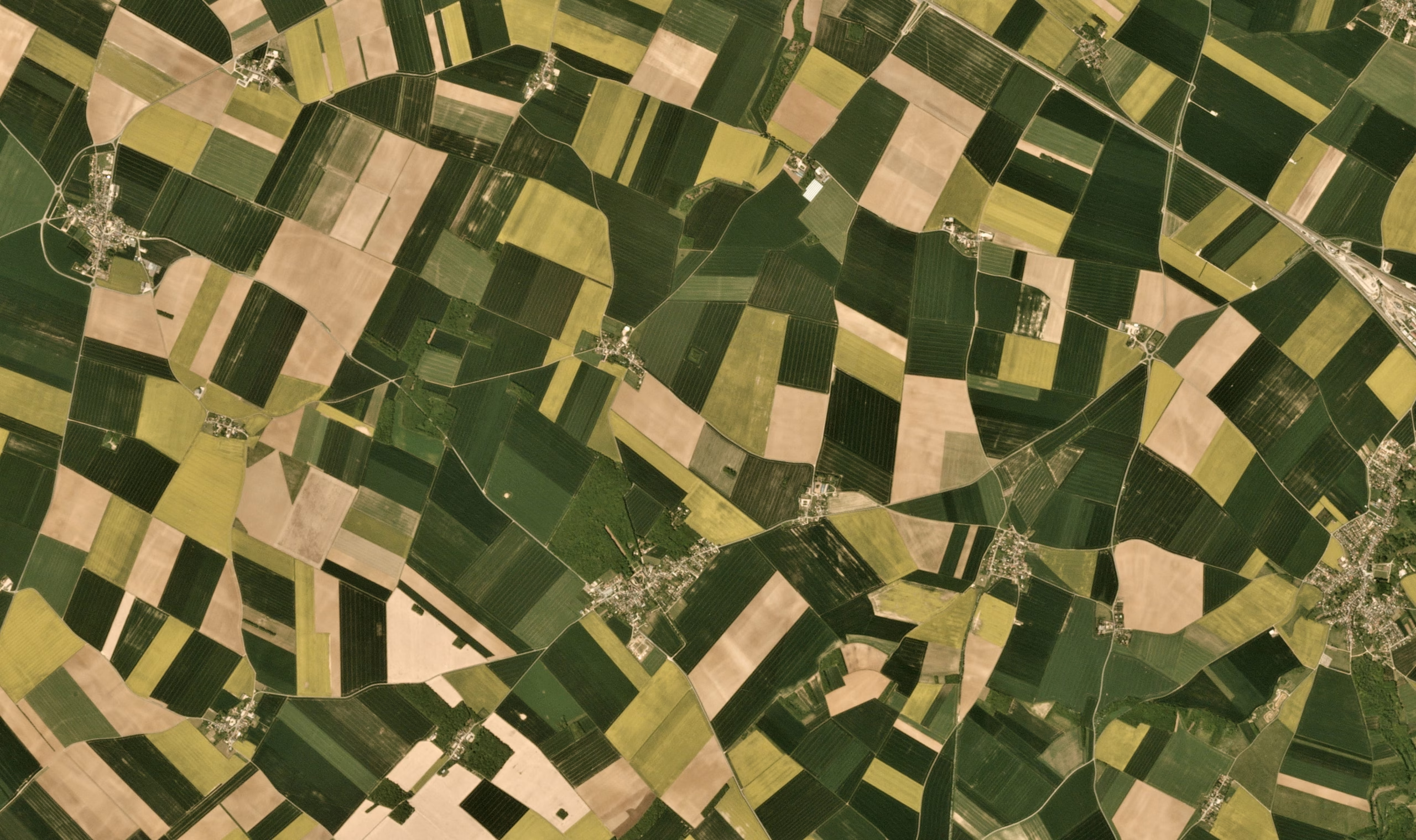
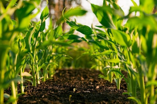
Enterprise-grade agricultural intelligence powered by 10+ satellite constellations and 2,000+ AI models — processing 900M+ hectares monthly across 80+ countries and 300+ crops.

6.2M+
Farmers Globally
80+
Countries
300+
Crops Supported
97%
AI Accuracy
Crop Health Index
0.84 NDVI
Above seasonal avg
Field: Block A3
Risk Alert
Moisture deficit
Yield Prediction
+31%
vs last season
Low
High NDVI
Backed & Trusted By
360 °
Agro Suite

Choose Your Agricultural
Intelligence Level

From farm digitisation to full enterprise command — one integrated platform covering every stage of your agricultural intelligence journey.

Digitize Track Intelligence Guide Scale
Tier 1 Farm Foundation — Get Digital
Farm Boundary Detection
Precise field maps without surveys. 97% accuracy across 80+ countries. Automated delineation in minutes.
Learn More
Crop Type Detection
Crop Type Detection
Identify 150+ crops automatically using multi-spectral satellite analysis. Verify insurance claims instantly.
Learn More
Crop Monitoring Platform
24/7 satellite health surveillance. Early disease alerts. NDVI and 20+ vegetation indices updated daily.
Learn More
Tree Monitoring Platform
Individual tree health scores for orchards and plantations. Yield optimisation and canopy change detection.
Learn More
Tier 2 Smart Operations — Get Optimized
Drone Monitoring Platform
Sub-meter precision analysis from drone imagery. Spot crop problems days before visible damage.
Learn More
Farm Detection Suite
Disease ID in under 5 seconds. Insurance damage assessment with satellite-verified evidence.
Learn More
Farm Prediction Suite
90% accurate yield forecasts up to 3 months ahead. Harvest planning automation and market readiness alerts.
Learn More
Forest Monitoring Platform
Deforestation alerts, compliance tracking, and carbon credit verification for enterprise ESG reporting.
Learn More
Tier 3 Command Center — Get Ahead
Irrigation Modelling Tool
20% water reduction through AI-modelled irrigation schedules. Zone-specific water stress maps and precision timing.
Learn More
Sustainable Agriculture Suite
ESG compliance scoring, carbon footprint tracking, and full sustainability reporting for agri-businesses.
Learn More
Risk Intelligence Suite
Automated risk scoring for lenders and insurers. 30% better default prediction with real-time portfolio dashboards.
Learn More
Proven Results

Real ROI, Real Farms,
Real Seasons

+30%
Average Yield Increase
-40%
Input Cost Reduction
95%
Customer Retention
3mo
Average ROI Payback

"MapMyCrop's satellite intelligence gave us the visibility to protect 2.4M acres of insured farmland. Default predictions improved by 31% in the first season."

— Regional Head of Agriculture, Leading Agri-Finance Institution
97%
AI Accuracy
900M+
Ha/Month
2,000+
AI Models
Industry Solutions

Built for Every
Agricultural Stakeholder

Tailored intelligence for every role across the full agricultural value chain.

banking-and-insurance
Banking & Insurance
Banking & Insurance
    • Satellite-verified loan underwriting
    • Real-time crop insurance monitoring
    • 30% better default prediction
Learn More
Government & Policy
Government & Policy
    • National crop area monitoring
    • Food security & subsidy planning
    • Disaster relief assessment
Learn More
Ag Cooperatives
Ag Cooperatives
    • Member farm performance tracking
    • Bulk yield aggregation & forecasting
    • Procurement planning automation
Learn More
Farmers & Growers
Farmers & Growers
    • Daily crop health field reports
    • Irrigation & fertiliser guidance
    • Market timing recommendations
Learn More
Plantation Owners
Plantation Owners
    • Individual tree health & canopy scoring
    • Multi-estate portfolio dashboards
    • ESG & carbon credit reporting
Learn More
Food Processing
Food Processing
    • FSMA 204 supply chain compliance
    • Harvest readiness monitoring
    • Quality & contamination risk alerts
Learn More
Input Companies
Input Companies
    • Precision application zone mapping
    • Demand forecasting by crop & region
    • Efficacy tracking post-application
Learn More
Agro Holdings & Enterprises
    • Multi-farm portfolio command view
    • M&A land assessment intelligence
    • Supply chain & procurement AI
Learn More
Platform Scale

Built for Billion-Dollar
Agricultural Operations

6.2M+
Farmers Globally
80+
Countries Deployed
6
Global Offices
900M+
Hectares Processed Monthly
300+
Crop Types Supported
2000,+
AI Models Deployed
1000s TB
Proprietary Training Data
30+%
Average Yield Increase
95%
Customer Retention
Recognition & Awards

Globally Recognised for
Agricultural Innovation

MapMyCrop has been honoured by leading technology, sustainability, and agri-innovation organisations worldwide — from Silicon Valley to New Delhi.

NVIDIA Inception Program — AI Partner & Member
2023 – Present
Google for Startups — Sustainability Fund Recipient
2022
National Startup Award — Agriculture Category Winner
2022
ISRO Authorised Data Partner — Remote Sensing Excellence
2021 – Present
Top 50 Global AgTech Innovators to Watch
2024
ET Startup Awards — Best AgriTech Startup Nominee
2023
AgFunder Innovation Award — Precision Ag Data Platform
2024
IFC Climate Tech Cohort — Sustainable Agriculture Track
2023

As Featured In

Get Started

See MapMyCrop
In Action

Request a personalised demo tailored to your industry and scale. Our team responds within 4 hours.

Live Satellite Demo We analyse your actual fields in real-time during the call
Custom ROI Analysis Projected returns based on your actual acreage and crop mix
Integration Walkthrough See exactly how MapMyCrop connects to your existing systems via API
Enterprise Pricing Volume, white-label, and government contract options available

Request a Demo

    🔒 No commitment required. Response within 4 hours on business days.